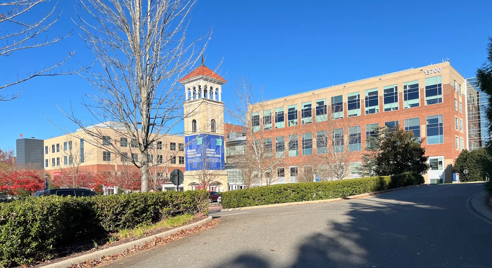
Centerpointe, by Route 288 and Powhite Parkway, is mostly apartments and townhouses recorded since 2013, in ZIP 23114 and the Midlothian High zone.
Last checked Oct. 19, 2026. Sources: Chesterfield County’s open GIS data (subdivision records, address points, school zones and parks), the Virginia Department of Education’s School Quality Profiles, Zillow Research, GRTC and OpenStreetMap.
Centerpointe is the newest part of Midlothian, at the southwest corner of the Census boundary along Center Pointe Parkway. Chesterfield County’s subdivision records date everything here from 2013 on, and most of its roughly 1,260 addresses are apartment and townhouse units: only about 400 are separate buildings or lots.
What this means for you
- Zoned high school: Midlothian High for the whole area. Check an address on the Find My School lookup.
- Home value: $468,325 in ZIP 23114 in September 2026, according to the Zillow Home Value Index.
- Nearest highway: Powhite Parkway at Charter Colony Parkway, about 1.1 miles by road.
Part of our Midlothian neighborhoods guide.
Where it is
The area lies south and west of Route 288 and north of Powhite Parkway, around Center Pointe Parkway, with Charter Colony to the north and Queensmill across Route 288 to the east. It is all in ZIP code 23114. It is outside the county’s Midlothian Community Special Area Plan, which stops at Route 288.
The county’s subdivision records name six developments. By number of addresses they are Luxe 360 on Centerpointe (recorded in 2020), Colony at Centerpointe, Sapphire at Centerpointe, Centerpointe Townhomes (recorded in 2022), Centerpointe Townes (recorded in 2020 and 2021) and Centerpointe Crossing (recorded from 2013 to 2016). A few addresses of the Abberly apartments and the St. Francis medical office condominiums also fall inside the line.
Next door, from OpenStreetMap: Bon Secours St. Francis Medical Center, 13710 St. Francis Blvd., Tomahawk Creek Middle, 1600 Learning Place Loop, and Thales Academy, a private school at 14101 Center Pointe Parkway. Chesterfield County, not a town, runs police, fire and planning here.
Schools
Shares are of the area’s county address points. All three schools are Fully Accredited for 2025-26 on Virginia’s School Quality Profiles; pass rates are for all students on the 2025-26 Standards of Learning tests.
| Level | School | Share of the area | Reading pass rate | Math pass rate |
|---|---|---|---|---|
| High | Midlothian High, 401 Charter Colony Parkway | 100% | 96% | 82% |
| Middle | Tomahawk Creek Middle, 1600 Learning Place Loop | 99% | 89% | 89% |
| Elementary | Evergreen Elementary, 1701 Evergreen East Parkway | 100% | 69% | 71% |
Tomahawk Creek Middle is the closest school, about a tenth of a mile from the area’s edge. Its enrollment fell from 1,650 in fall 2024 to 952 in fall 2025, according to the state’s figures in our schools guide. A handful of addresses at the edge are zoned for Midlothian Middle, so check the exact address on the lookup.
Home values
The typical home value in ZIP 23114 was $468,325 in September 2026, up 2.7% from $456,008 a year earlier, according to the Zillow Home Value Index. The index is a modeled typical value for the middle third of homes, not a sale price, and covers the whole ZIP code, so it says little about apartment rents here. Zillow’s figure for its Midlothian area was $468,594. More in our home prices guide.
Parks and trails
No open county park is inside or touching the area. The county’s park layer lists the Windmill-Old Hundred Road Park site, about half a mile west, as unopened. The nearest open county park is Mid-Lothian Mines Park, 13301 N. Woolridge Road, about 1.8 miles northeast in a straight line, open 6 a.m. to 8:30 p.m. daily. OpenStreetMap shows Watermill Lake about a third of a mile southwest, in the neighboring Watermill subdivision. More in our parks and trails guide.
Getting around
- Highways: about 1.1 miles by road to Powhite Parkway at Charter Colony Parkway, and about 4.2 miles to Route 288 at Midlothian Turnpike.
- The village, downtown and the airport: about 3 miles to Midlothian Turnpike at Coalfield Road, 16 miles to downtown Richmond and 27 miles to Richmond International Airport.
Distances are measured on the OpenStreetMap road network with the OSRM routing engine from the middle of the area; they are not drive times.
- Buses: GRTC’s schedule data for Oct. 18, 2026, to Jan. 23, 2027, has no stop in or near the area. The nearest is the Route 1A stop at Walmart Way, about 2.6 miles away.
More in our getting around guide.
Groceries and everyday stores
From OpenStreetMap, measured in a straight line from the area:
- Harness Health Pharmacy, 13710 St. Francis Blvd., at the medical center next door
- Colony Crossing shopping center, about half a mile south across Powhite Parkway
- Food Lion, Wilton Square at Brandermill on Genito Road, about 1.7 miles south
- Kroger, 14241 Midlothian Turnpike, about 2.2 miles north
How we drew this area
The area is every county-recorded Centerpointe development inside the Census boundary, plus the few unsubdivided addresses around Center Pointe Parkway zoned for Evergreen Elementary. School and ZIP shares are counts of county address points, checked Oct. 19, 2026. Store and road locations are © OpenStreetMap contributors.
Frequently asked questions
What schools serve Centerpointe in Midlothian?
In the county’s address data the whole area is zoned for Evergreen Elementary and Midlothian High, and all but a few addresses for Tomahawk Creek Middle, which is on Learning Place Loop next to the area.
What ZIP code is Centerpointe, Midlothian?
- Zillow’s typical home value for 23114 was $468,325 in September 2026, up 2.7% in a year. The index covers the whole ZIP code, not just Centerpointe.
Is there a hospital near Centerpointe?
Yes. Bon Secours St. Francis Medical Center, 13710 St. Francis Blvd., is next to the area, according to OpenStreetMap.
How far is Centerpointe from Powhite Parkway?
About 1.1 miles by road to the Powhite Parkway interchange at Charter Colony Parkway, measured on the OpenStreetMap road network.
Have your say